454 results on '"Booth, Charles"'
Search Results
2. Geography at Eastern Washington University
3. Maps and Civilization, Cartography in Culture and Society by Norman J. W. Thrower (review)
4. A test to determine the response of Pinus radiata to the application of nitrogen
5. Conformational dynamics of complement protease C1r inhibitor proteins from Lyme disease– and relapsing fever–causing spirochetes
6. Minimal role for the alternative pathway in complement activation by HIT immune complexes
7. The dual activity of BBK32: Implications for simultaneous inhibition of borrelial-specific antibody-dependent complement activation and fibronectin binding
8. Characterizing arginine, ornithine, and putrescine pathways in enteric pathobionts
9. “Returning Home to Fight”
10. 5. “Returning Home to Fight”: Bristolians in the Dominion Armies, 1914–1918
11. Boundary work in theory and practice : past, present and future
12. Public professionals or public servants? Making sense of UK local government professional bodies’ codes of ethics
13. “Conformational dynamics of C1r inhibitor proteins from Lyme disease and relapsing fever spirochetes”
14. Cyber-Resiliency for Digital Enterprises: A Strategic Leadership Perspective
15. Climatology of Ultraviolet Radiation at High Latitudes Derived from Measurements of the National Science Foundation’s Ultraviolet Spectral Irradiance Monitoring Network
16. Property Rights, Collateral, Creditor Rights, and Insolvency in East Asia 1
17. Borrelia miyamotoi FbpA and FbpB Are Immunomodulatory Outer Surface Lipoproteins With Distinct Structures and Functions
18. The genre of corporate history
19. A Complex Case: Using the Case Study Method To Explore Uncertainty and Ambiguity in Undergraduate Business Education.
20. The 2006 PRC Enterprise Bankruptcy Law: The Wait Is Finally Over
21. Networks and Inter-Organizational Learning: A Critical Review.
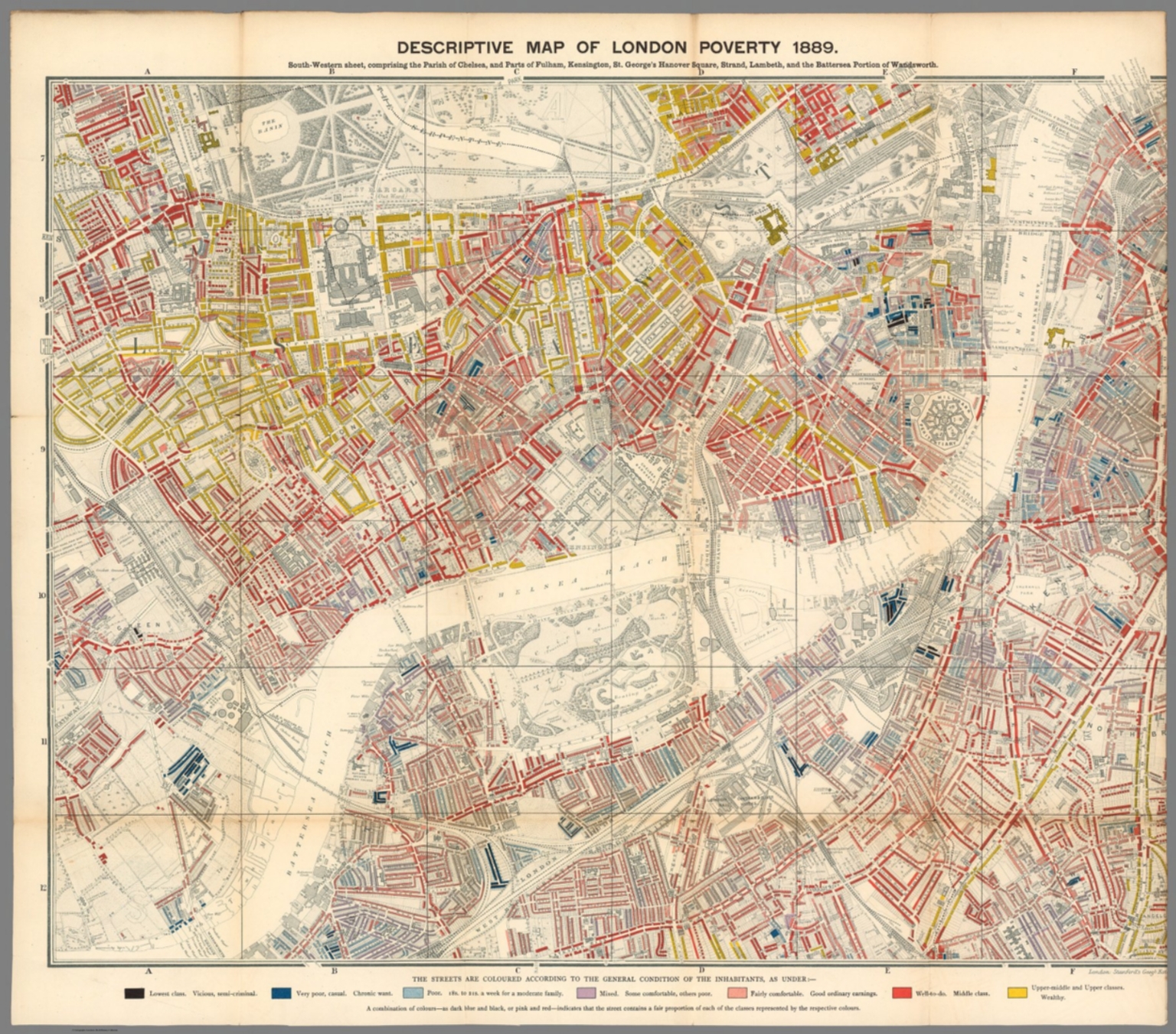
22. Descriptive map of London poverty 1889. South-Western sheet comprising the Parish of Chelsea and parts of Fulham, Kensington, St. George's Hanover Square, Strand, Lambeth, and the Battersea portion of Wandsworth. London. Stanford's Geogl. Estabt. (to accompany) Labour and life of the people. Appendix to volume II. Edited by Charles Booth. William and Norgate, London; Edinburgh. 1891.
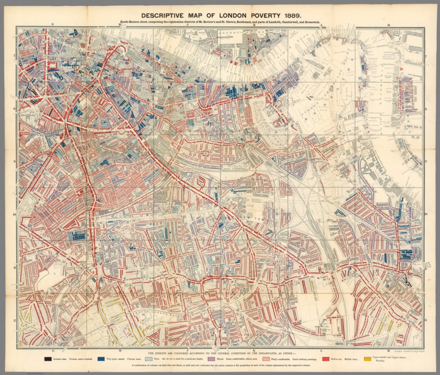
23. Descriptive map of London poverty 1889. South-Eastern sheet comprising the registration districts of St. Savior's and St. Olave's Soutwark, and parts of Lambeth and Camberwell, and Greenwich. London. Stanford's Geogl. Estabt. (to accompany) Labour and life of the people. Appendix to volume II. Edited by Charles Booth. William and Norgate, London; Edinburgh. 1891.
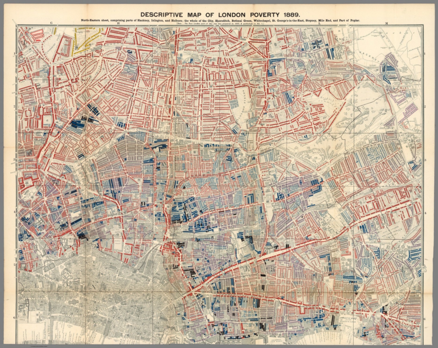
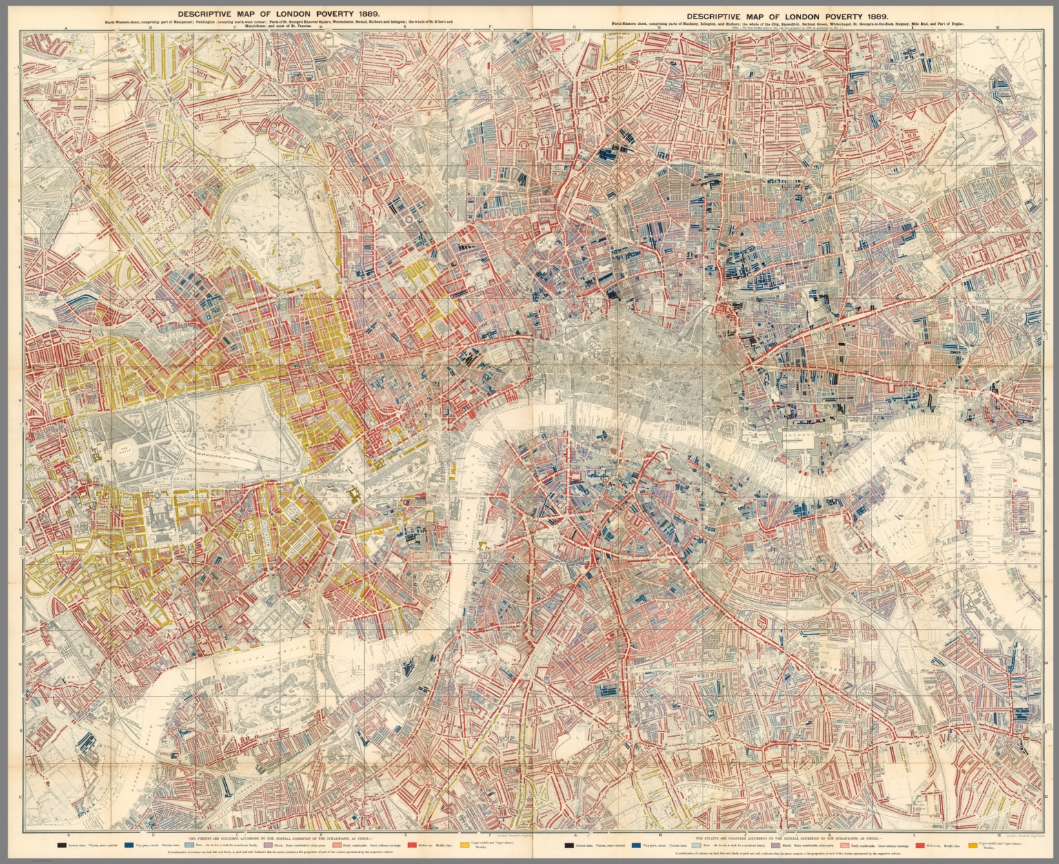
24. Descriptive map of London poverty 1889. North-Eastern sheet comprising parts of Hackney, Islington, and Holborn; the whole of the city Shoreditch, Bethnal Greek, Whitechapel, St. George's -in-the-East, Stepney, Mile End, and part of poplar. London. Stanford's Geogl. Estabt. (to accompany) Labour and life of the people. Appendix to volume II. Edited by Charles Booth. William and Norgate, London; Edinburgh. 1891.
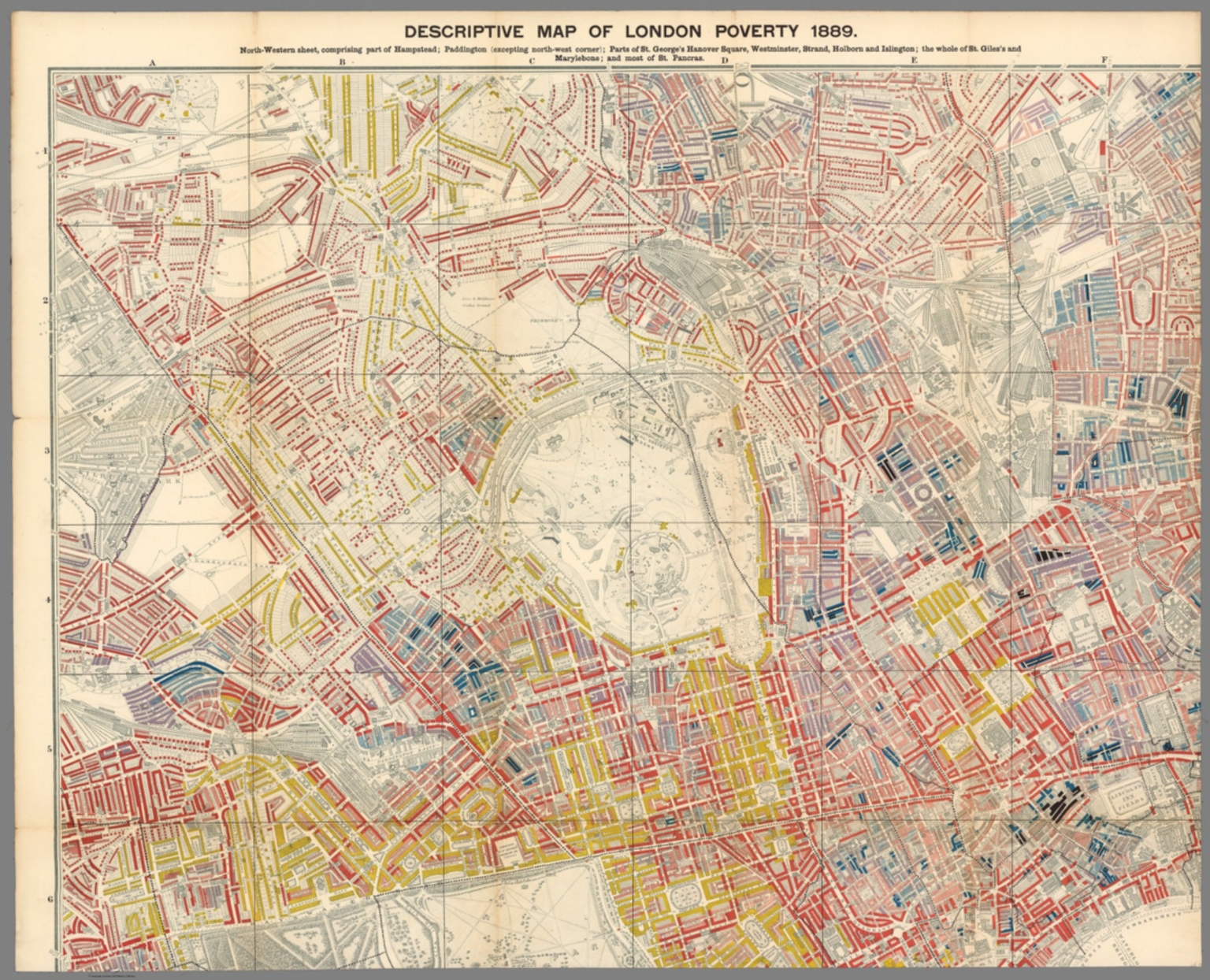
25. Descriptive map of London poverty 1889. North-Western sheet comprising part of Hampstead; Paddington (excepting north-west corner) ; parts of St. George's Hanover Square, Westminster, Strand, Holborn, and Islington; the whole of St. Giles's and Marylebone; and most of St. Pancras. London. Stanford's Geogl. Estabt. (to accompany) Labour and life of the people. Appendix to volume II. Edited by Charles Booth. William and Norgate, London; Edinburgh. 1891.
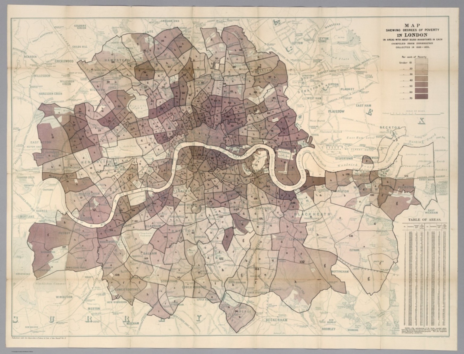
26. Map shewing degrees of poverty in London : in areas with about 30,000 inhabitants in each compiled from information collected in 1889-1890. (to accompany) Labour and life of the people. Appendix to volume II. Edited by Charles Booth. William and Norgate, London; Edinburgh. 1891.
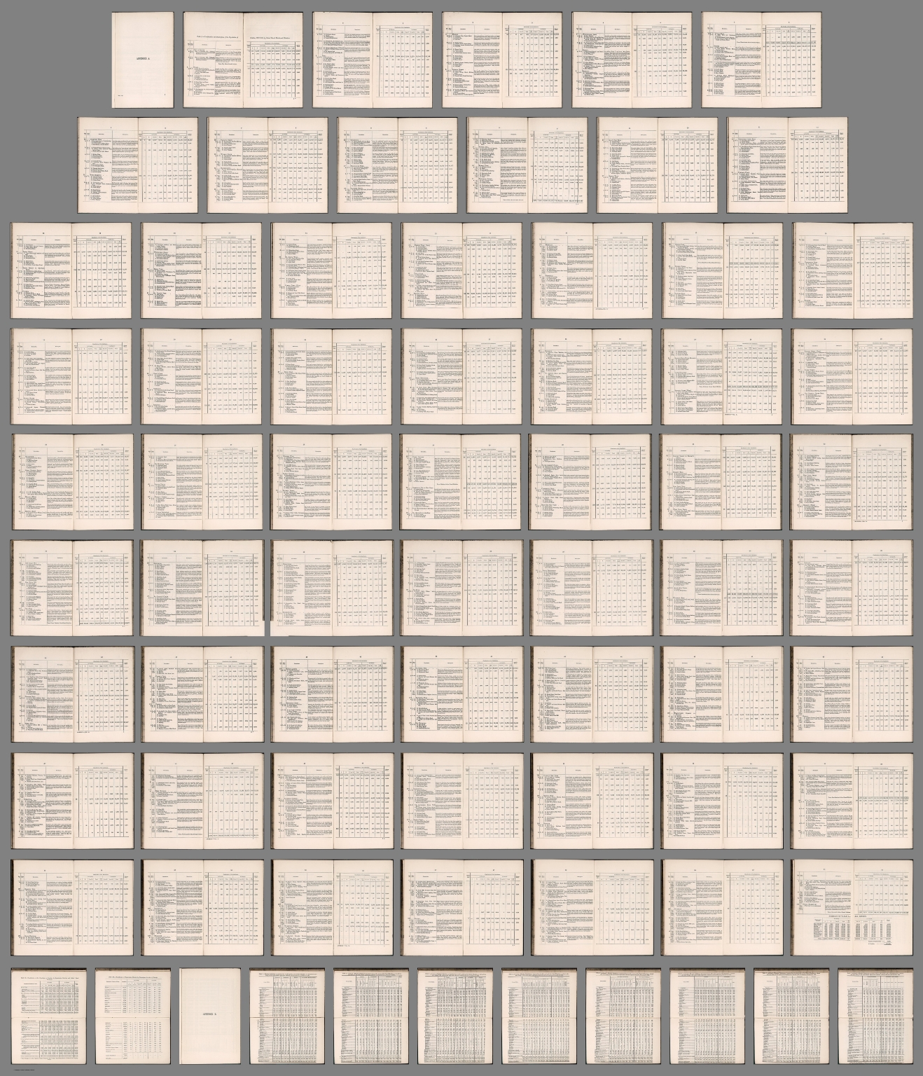
27. (Composite text) Labour and life of the people. Appendix to volume II. Edited by Charles Booth. William and Norgate, London; Edinburgh. 1891. (on verso) London: G. Norman and Son. (with maps) Descriptive map of London poverty, 1889. (with) Map shewing degrees of poverty in London.
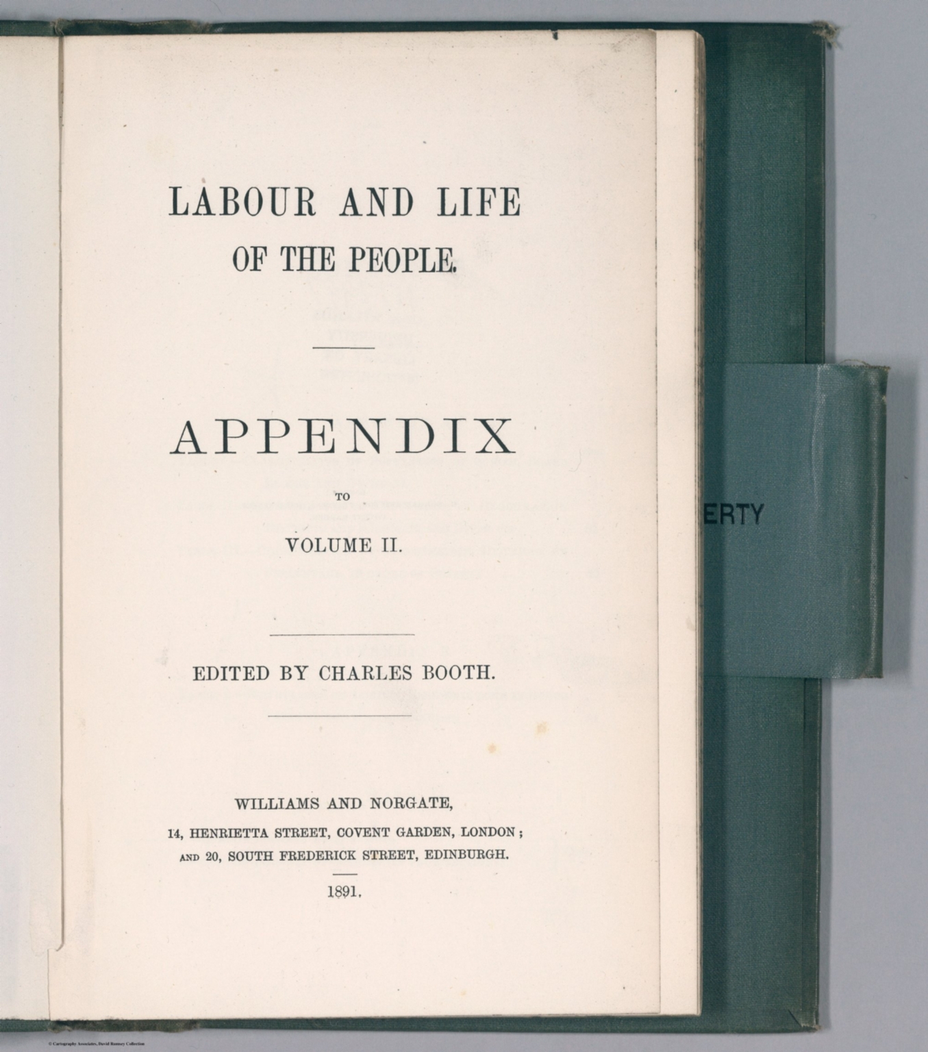
28. (Title Page to) Labour and life of the people. Appendix to volume II. Edited by Charles Booth. William and Norgate, London; Edinburgh. 1891. (on verso) London: G. Norman and Son. (with maps) Descriptive map of London poverty, 1889. (with) Map shewing degrees of poverty in London.
29. (Composite map) Descriptive map of London poverty 1889. (to accompany) Labour and life of the people. Appendix to volume II. Edited by Charles Booth. William and Norgate, London; Edinburgh. 1891.
30. London, 1899-1900. Map showing Places of Religious Worship, Public Elementary Schools, and Houses Licensed for the Sale of Intoxicating Drinks.
31. Descriptive Map of London Poverty, Compiled From School Board Visitors' Reports in 1887.
32. Does history matter in strategy? The possibilities and problems of counterfactual analysis
33. Networks and inter‐organizational learning: a critical review
34. Minimal Role for the Alternative Pathway in Complement Activation By HIT Immune Complexes
35. The New Avoidance Powers under Hong Kong Insolvency Law: A Move from Territoriality to Extraterritoriality
36. Scenarios and counterfactuals as modal narratives
37. Analysis of Hemolymph Oxygen Levels and Acid-Base Status during Emersion 'in situ' in the Red Rock Crab, Cancer productus
38. Underwater Radiant Energy Absorbed by Phytoplankton, Detritus, Dissolved Organic Matter, and Pure Water
39. The Design and Evaluation of a Measurement System for Photosynthetically Active Quantum Scalar Irradiance
40. Resisting the Municipal Construction Claim
41. Taking Advantage of Lester: How a Couple Can Split the Tax Burden After Splitting Up
42. Occupations of the People of the United Kingdom, 1801-81
43. Poor Law Statistics as Used in Connection with the Old Age Pension Question
44. Poor Law Statistics
45. The Enumeration of Paupers--A Correction
46. The Inaugural Address of Charles Booth, Esq., President of the Royal Statistical Society. Session 1892-93. Delivered 15th November, 1892
47. Enumeration and Classification of Paupers, and State Pensions for the Aged
48. The Inhabitants of Tower Hamlets (School Board Division), Their Condition and Occupations
49. Condition and Occupations of the People of East London and Hackney, 1887
50. Life and Labour of the People in London: First Results of An Inquiry Based on the 1891 Census. Opening Address of Charles Booth, Esq., President of the Royal Statistical Society. Session 1893-94
Catalog
Books, media, physical & digital resources
Discovery Service for Jio Institute Digital Library
For full access to our library's resources, please sign in.
