Back to Search
Start Over
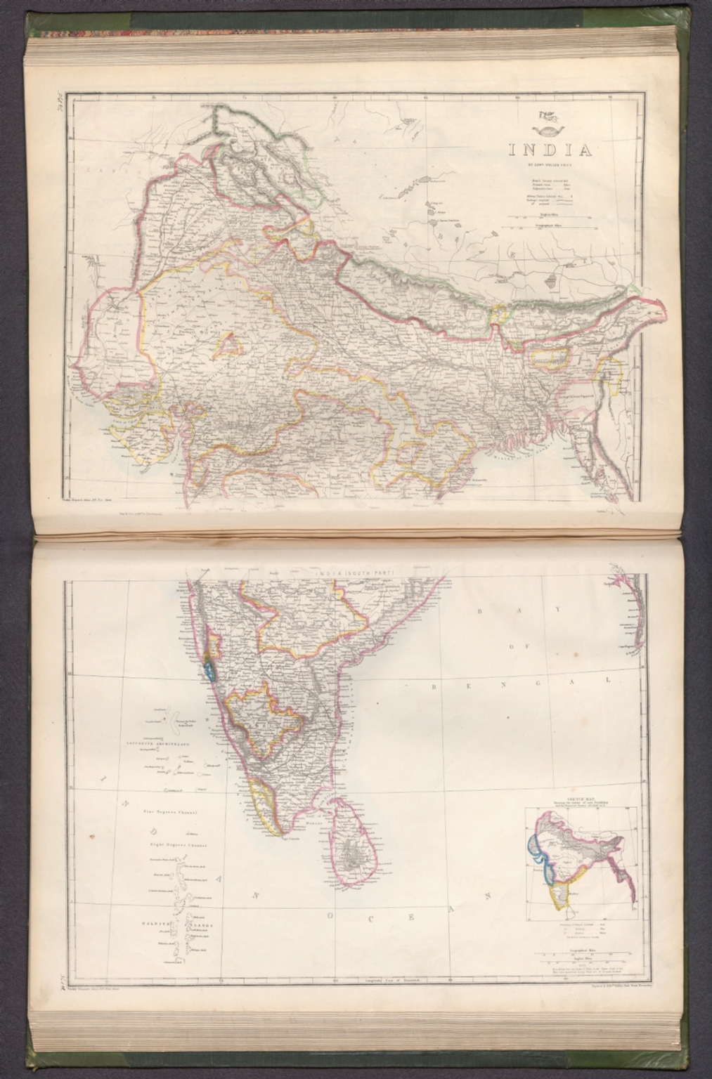
India : (South part) [North part]. / by Edwd. Weller F. R. G. S. ; engraved by Edwd. Weller, Duke Street Bloomsbury.
- Publication Year :
- 1863
- Publisher :
- Weekly Dispatch, London, 1863.
-
Abstract
- Map of India (south and north parts). Shows political boundaries (delineating British territories and independent states), cities, military stations, railways, topography, bodies of water, drainage, coastlines and islands. Relief shown with hachures. Includes latitudinal and longitudinal lines, as well as a legend and bar scales given in English and geographical miles. With inset map: Sketch map, showing the extent of each Presidency and the Protected States attached to it. Hand-colored lithograph. Map is 60 x 42 cm, on two sheets, together 69 x 48 cm. Sheets presented in sequence. Appears in Vol. II : Foreign.<br />The dispatch atlas, in two volumes: Vol. I : British and .Vol. II : Foreign. Published by the Weekly Dispatch, London, 1863. Includes a preface, directions for binding and a table of contents for both volumes, which lists the maps in order of appearance, with plate numbers handwritten beside map titles. Preface begins: The subscribers to the Weekly Dispatch have in this collection the most full and accurate survey of the world's surface that has yet been presented to the public in any single series. Both volumes bound in board covered in dark green linen, with spine and corners in calf. Gilded spine titles, as well as ornamentation on spines and front and back covers. With marbled end papers and gilded page edges. Collation: Volume I: [6] pages, 129 leaves of plates (some double); Volume II: 147 leaves of plates (some double). The work’s total 276 plates contain 300 maps. Each plate number handwritten in ink above map. First volume focuses on the British Isles, especially England. Second volume covers the larger globe, featuring Europe, the Middle East, Asia, Africa, North America, Central America, South America, Australia, New Zealand, the Pacific Ocean and the Arctic. Maps show political boundaries, cities, fortresses, railways, roads, bridges, canals, ocean routes, topography, glaciers, bodies of water, drainage, coastlines, shoals, islands and water depths. Maps of the Americas include territories of indigenous peoples. Maps of the United States south delineate between Federal, Border and Confederate States. Some maps feature English translations of terms from other languages that describe geographic features, including the “Explanation of Arabic words" - such as nahr for river - in the Map of Syria. Maps created by Edward Weller, J. W. Lowry, B. R. Davies, John Dower and T. Ettling; printed by Edward Weller and Day & Son, Lithographers to The Queen.
- Subjects :
- Military
Subjects
Details
- Database :
- LUNA Commons
- Publication Type :
- Map
- Accession number :
- edsluc.RUMSEY.8.1.343695.90111782
- Document Type :
- World Atlas<br />Atlas Map