Back to Search
Start Over
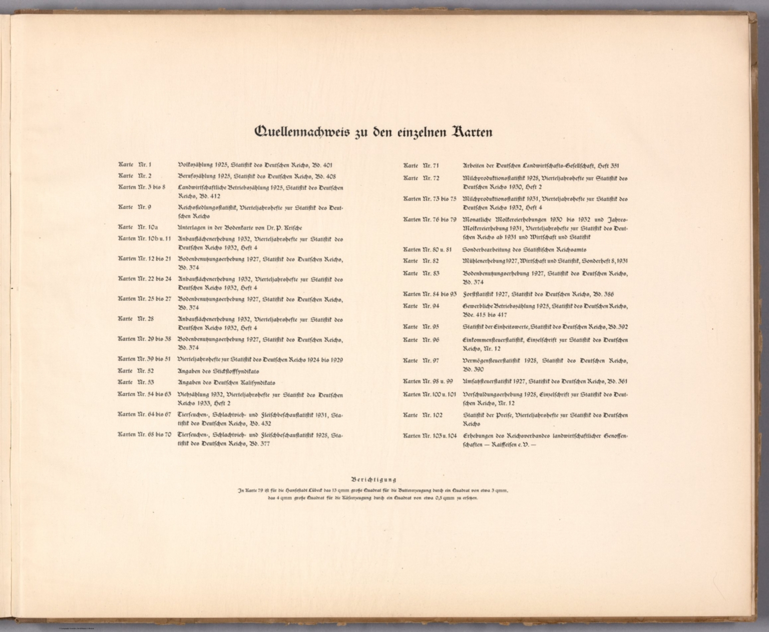
(Text Page to) Quellennachweis zu den einzelnen Karten.
- Publication Year :
- 1934
- Publisher :
- Reimar Hobbing, Berlin, 1934.
-
Abstract
- Citations to Deutscher Landwirtschaftsatlas. Lists maps with associated references. Includes a correction. Text on verso: Reichsdruckerei, Berlin, 595 33 II D.<br />Deutscher Landwirtschaftsatlas, by the Statistischen Reichsamt [Reich Statistical Office]; published in Berlin by Reimar Hobbing, 1934. Title translates to: German agricultural atlas. Bound in tan-colored board with linen-reinforced spine. Front cover includes title and imprint; and has an outline map of Germany, as well as the German coat of arms. With spine title. Collation: [1-4], 5-32 pages, 104 leaves of plates, [2] pages. Atlas includes a title page, foreword, table of contents, descriptive texts on the development of German agriculture and forestry, as well as a list of citations. Plates comprised of 117 maps of the German Empire. Maps feature themes such as soils, land use, crop harvests, livestock, animal diseases, forest types and economics. Maps also show political boundaries, regions, routes, bodies of water, drainage, coastline and islands. Maps include legends, explanatory notes, as well as data visualization.
Details
- Database :
- LUNA Commons
- Publication Type :
- Map
- Accession number :
- edsluc.RUMSEY.8.1.343032.90110981
- Document Type :
- National Atlas<br />Thematic Atlas<br />Text Page