Back to Search
Start Over
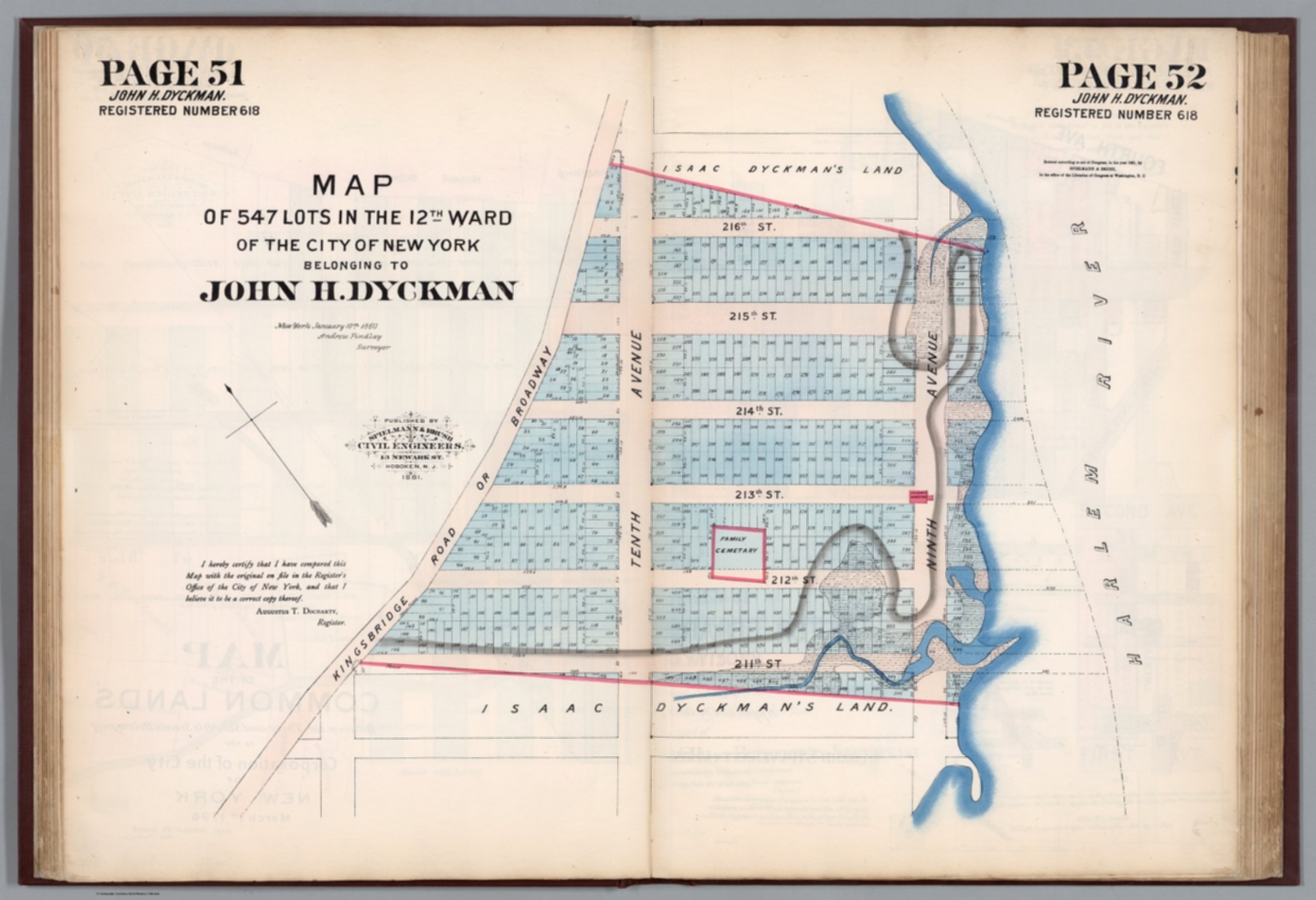
Map of 547 lots in the 12th Ward of the City of New York belonging to John H. Dyckman. New York Janyary 10th. 1860 Andrew Findlay, Surveyor. Published by Spielmann & Brush, civil engineers, Hoboken, N.J. 1881. (to accompany) Certified copies of original maps of property in New York City.
- Publication Year :
- 1796
- Publisher :
- Spielmann & Brush, civil engineers, Hoboken, N.J., 1796.
-
Abstract
- Hand colored cadastral map. Includes notes. Oriented with north to the upper left.<br />First edition of atlas of the New York common lands as surveyed, with 186 pages of 93 double-page hand-colored lithograph maps and 8 incomplete pages of Notes prepared by Leonard A. Bradley, Counselor at law, concerning the land titles, with detailed information about many of the record series. Note is Lacking pages 9-26. Maps contain brief descriptions of land title records, types of deeds, creating agency, and date span. Showing the original history of the island, with all the block measurements, tracts, lot number, land owner, streets and waterways. Uniform street grid of Manhattan laid on top of the former property lines of farms. Bound in dark red cloth covered boards with title “Filed maps of New-York City, N.Y.” in gilt pasted on front cover and stamped on spine.
- Subjects :
- Real property
Deed
Survey
Subjects
Details
- Database :
- LUNA Commons
- Publication Type :
- Map
- Accession number :
- edsluc.RUMSEY.8.1.323794.90093012
- Document Type :
- City Atlas<br />Atlas Map