Search

Showing total 948 results

Search Constraints

Start Over You searched for: Publication Type Maps Remove constraint Publication Type: Maps Publisher london Remove constraint Publisher: london
948 results

Search Results

1. (Text page to) A map of the County of Devon, with the city and county of Exeter, delineated from an actual survey, on twelve sheets of Imperial paper, the scale an inch to a mile

2. (Text page to) A map of the County of Devon, with the city and county of Exeter, delineated from an actual survey, on twelve sheets of Imperial paper, the scale an inch to a mile

3. (Text page to) A map of the County of Devon, with the city and county of Exeter, delineated from an actual survey, on twelve sheets of Imperial paper, the scale an inch to a mile

4. (Text page to) A map of the County of Devon, with the city and county of Exeter, delineated from an actual survey, on twelve sheets of Imperial paper, the scale an inch to a mile

5. (Text page to) A map of the County of Devon, with the city and county of Exeter, delineated from an actual survey, on twelve sheets of Imperial paper, the scale an inch to a mile

6. 12. A map of the County of Devon, with the city and county of Exeter, delineated from an actual survey, on twelve sheets of Imperial paper, the scale an inch to a mile

7. 9. A map of the County of Devon, with the city and county of Exeter, delineated from an actual survey, on twelve sheets of Imperial paper, the scale an inch to a mile

8. 11. A map of the County of Devon, with the city and county of Exeter, delineated from an actual survey, on twelve sheets of Imperial paper, the scale an inch to a mile

9. 10. A map of the County of Devon, with the city and county of Exeter, delineated from an actual survey, on twelve sheets of Imperial paper, the scale an inch to a mile

10. 8. A map of the County of Devon, with the city and county of Exeter, delineated from an actual survey, on twelve sheets of Imperial paper, the scale an inch to a mile

11. 7. A map of the County of Devon, with the city and county of Exeter, delineated from an actual survey, on twelve sheets of Imperial paper, the scale an inch to a mile

12. 6. A map of the County of Devon, with the city and county of Exeter, delineated from an actual survey, on twelve sheets of Imperial paper, the scale an inch to a mile

13. 5. A map of the County of Devon, with the city and county of Exeter, delineated from an actual survey, on twelve sheets of Imperial paper, the scale an inch to a mile

14. 4. A map of the County of Devon, with the city and county of Exeter, delineated from an actual survey, on twelve sheets of Imperial paper, the scale an inch to a mile

15. 3. A map of the County of Devon, with the city and county of Exeter, delineated from an actual survey, on twelve sheets of Imperial paper, the scale an inch to a mile

16. 2. A map of the County of Devon, with the city and county of Exeter, delineated from an actual survey, on twelve sheets of Imperial paper, the scale an inch to a mile

17. 1. A map of the County of Devon, with the city and county of Exeter, delineated from an actual survey, on twelve sheets of Imperial paper, the scale an inch to a mile

18. (Covers to) A map of the County of Devon, with the city and county of Exeter, delineated from an actual survey, on twelve sheets of Imperial paper, the scale an inch to a mile

19. (Title page to) A map of the County of Devon, with the city and county of Exeter, delineated from an actual survey, on twelve sheets of Imperial paper, the scale an inch to a mile

20. (Composite map to) 1-12 A map of the County of Devon, with the city and county of Exeter, delineated from an actual survey, on twelve sheets of Imperial paper, the scale an inch to a mile

21. Part of the Himalaya Mountains, to illustrate Capt. Strachey's Paper.

22. (Covers to) [A chronological and historical chart of modern Europe, from the year A.D. 827 to 1830; showing, in parallel columns, the kings, queens, etc., of each country, with all the remarkable events, notable characters, etc. in each reign.]

23. Sheet 13 and 16

24. Sheet 15

25. Sheet 17

26. Sheet 18

27. Sheet 14

28. Sheet 12

29. Sheet 11

30. Sheet 10

31. Sheet 8

32. Sheet 9

33. Sheet 7

34. Sheet 6

35. Sheet 3

36. Sheet 5

37. Sheet 4

38. Sheet 1

39. Sheet 2

40. Composite: Sheets 1 - 18

41. Index Sheet 1

42. (Covers to) Playfair French politics.

43. (Advertisement to) James Wyld, Geographer to the Queen, 11 and 12, Charing Cross, S.W., and 2, Royal Exchange, E.C. (1).

44. (Covers to) A Hand book for plain and ornamental mapping, and engineering drawing : consisting of every style of embellishment and writing used by surveyors and civil & mechanical engineers ; containing many original designs and sketches for hills, trees, cliffs, rocks, north-points, scrolls, borders, & titles for estate & parish maps, railway plans, and sections, and every description of ornament required in the above professions. By Benjamin P. Wilme, Civil –Engineer & Surveyor. London, Published by John Weale, Martin Taylor … 1841. Gardner, Zincographer, 19, Giltspur St.

45. (Title Page to) A Hand book for plain and ornamental mapping, and engineering drawing : consisting of every style of embellishment and writing used by surveyors and civil & mechanical engineers ; containing many original designs and sketches for hills, trees, cliffs, rocks, north-points, scrolls, borders, & titles for estate & parish maps, railway plans, and sections, and every description of ornament required in the above professions. By Benjamin P. Wilme, Civil –Engineer & Surveyor. London, Published by John Weale, Martin Taylor … 1841. Gardner, Zincographer, 19, Giltspur St.

46. (Title Page to) A hand-book for mapping, engineering, and architectural drawing, in which maps of all descriptions are analyzed, and their several uses fully explained : intended for the use of civil engineers, architects, and surveyors : also for naval and military academies, engineering schools and colleges, and draughtsmen : illustrated with forty-three large plates and thirty-nine woodcuts, among which will be found examples of a parliamentary railway plan, section, and cross sections, prepared in compliance with the standing orders of the House of Commons, with plain instructions for lithographing and zincographing maps and drawings, and an exposition of the relative cost and merits of engraving, lithographing, and zincographing. By B. P. Wilme … London : Published for the author, by John Weale, 1846.

47. (Covers to) A series of large colored diagrams illustrative of physical geography, compiled from the best authorities; comprising the physical features of the land. The phenomena and movements of the waters. The distribution of the rain. Diagram of climates. The volcanic system of the globe. London : Published by James Reynolds, 174, Strand.

48. A Map of the County of Devon, abridged from the 12 Sheet Survey.

49. (Covers to) General chart, Cook. (Verso)

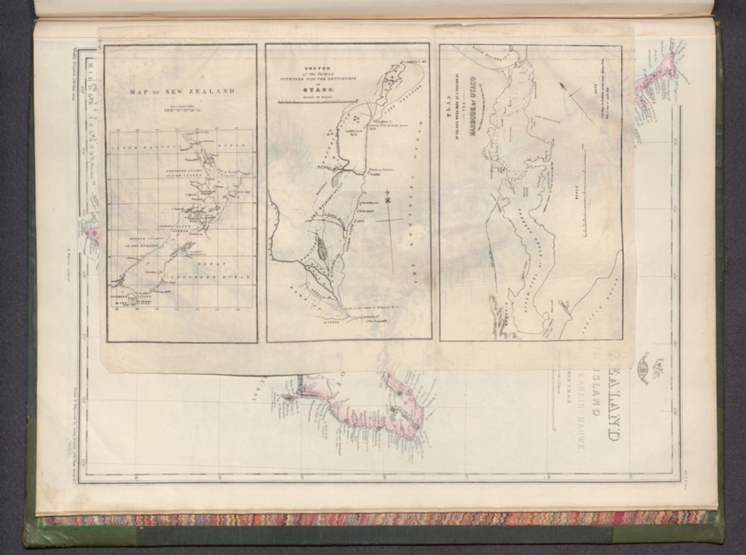
50. Map of New Zealand -- Sketch of the district intended for the settlement of Otago -- Plan of the high water mark of a portion of the Harbour of Otago, with a sketch of the banks dry on the ebb tide.